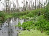


Access to Geospatial Data
The central register of forms of nature conservation is kept pursuant to Art. 113, § 1 of the Act of 1 May 2004, on nature conservation by the General Director for Environmental Protection at crfop.gdos.gov.pl. Pursuant to Art. 113 § 4 of the Act the authority that created or established a given form of nature protection (...) delivers a copy of the act on creation or establishment of a given form of conservation to the General Director for Environmental Protection within 30 days from the date of creation or establishment (...) and enters this information into the central register of forms of nature protection within the same period. Currentness of data entered into the register depends significantly on realization of the statutory duty by applicable bodies, i.e.:
- Municipal councils in the scope of natural monuments, documentation sites, landscape-nature complexes and ecological areas,
- Regional assemblies in the scope of landscape parks and protected landscape area,
- Regional director for environmental protection in the scope of nature reserves,
- General Directorate for Environmental Protection in the scope of Natura 2000 areas,
- Director of a national park in the scope of national parks.
It needs to be stressed that despite the fact that data presented at crfop.gdos.gov.pl, geoserwis.gdos.gov.pl and www.gdos.gov.pl//access-to-geospatial-data come from legal acts on nature conservation forms and are obtained on the basis of those acts, they do not constitute a legal arrangement of location and course of the nature conservation borders. Therefore, in order to perform legal actions and enforce law, provisions of legal acts on establishment of the form of nature or other applicable legal acts should be employed directly, and in case any uncertainties should be contacted directly the authority, the competences of which embrace a given form.
In order to present spatial data concerning, inter alia, forms of nature protection in Poland, the General Director for Environmental Protection maintains an interactive map website - Geoserwis, available at geoserwis.gdos.gov.pl.
As part Geoserwis, two services have been made available on open standards created by the Open Geospatial Consortium in accordance with Directive 2007/2/EC of the European Parliament of the European Union on 14 March 2007 on Infrastructure for Spatial Information in the European Community and the provisions of the Act of 4 March 2010 on spatial information infrastructure:
- WMS browsing service: http://sdi.gdos. gov.pl/wms, which provides the data in a raster format through HTTP
- WFS download service: http://sdi.gdos.gov.pl/wfs, which provides data in vector format through HTTP.
These services are compatible with most of the family of spatial information systems (GIS) such as ESRI ArcGIS or QGIS, where they can be freely analyzed and converted into the most popular formats (including ESRI Shapefile). Thanks to the WFS service you can also download the data for each of the forms of protection of nature directly to this format through the below links:
- National parks
- Landscape parks
- Nature reserves
- Protected landscape areas
- Special areas of conservation ("habitats" Natura 2000)
- Special protection areas ("Bird" Natura 2000)
- landscape-nature complexes
- Documentation sites
- Ecological areas
- Natural monuments (division into provinces)
- dolnośląskie
- kujawsko-pomorskie
- lubelskie
- lubuskie
- łódzkie
- małopolskie
- mazowieckie
- opolskie
- podkarpackie
- podlaskie
- pomorskie
- śląskie
- świętokrzyskie
- warmińsko-mazurskie
- wielkopolskie
- zachodniopomorskie - RAMSAR Areas
- Landscape Convention (mezoregions)
- Ecological corridors
In case of difficulties with the network service provider to retrieve spatial data, please refer to the video tutorials:
- the use of Web Feature Service in ArcGIS,
- the use of Web Feature Service in QGIS,
- the use of Geoserwis to check the presence of forms of nature protection in a particular field.
Metadane do powyższych usług: geoserwis.gdos.gov.pl/metadane
Further help and explanations can be obtained from Faculty of Geospatial Information, Department of Natural Resources Management Information - tel.: 22 369-21-65, 22 369-10-02.
")